Everyone talks about weather stations, but it’s not easy to know where the market really stands. There are many station suppliers, the data sources are very varied, and the economic models associated with weather stations are of all kinds: sale of stations, station rentals, sale/rental to distributors, subscription to a station network, shared access to a station, farmers equipped with several stations…
Some studies and testimonies (Agrinaute, Terre-Net, Observatoire des usages du numérique en agriculture…) suggest that, In France, about 15% of farmers are equipped with a connected weather station, and that at least 20,000 weather stations could be found in France for agricultural applications. However, once you say that, you haven’t really said much… And to add that the arboricultural sector is not always represented in these works.
What are the issues around weather stations? What can we do with them? What should we pay attention to? We will try to reposition the weather stations in an operational context and to give reading tips to arboriculturists who have questions on the subject.
This blog post was produced between the end of 2020 and the beginning of 2021 as part of a service contract, almost 2 years before I opened it publicly on the blog. I have slightly organized it for the blog format but the substance has changed very little. The objective was to make arborists and field operators (technicians, advisors…) of an agricultural actor (I won’t mention its name here) aware of connected weather stations. Nevertheless, I didn’t get much feedback on the further dissemination of this work. We’ll say “no news, good news” to reassure ourselves a bit.
I also take the opportunity to bring this work out of limbo in preparation of a next big blog post on water and digital in agriculture. More in a future episode! It would also be a pity not to advertise again the directory of digital tools for agriculture in which a lot of actors offering connected weather stations are listed. In addition to being used for collaborative monitoring, this platform is now used to take a step back on the digital tools in place and to identify trends.
This work around connected weather stations is significantly different from other blog posts. It’s a fairly short file (I can already hear big phew’s of relief) and much more operationally focused. This document is a synthesis of interviews with French technical institutes and actors who, in their great majority, are interested in arboriculture and the use of weather stations:
- Arvalis,
- CEFEL (Fruit and Vegetable Experimentation Center),
- CETA (Center for Agricultural Technical Studies) of Cavaillon,
- CTIFL (Interprofessional technical center for fruits and vegetables)
- CRIAMM (former CIRAME and Ardepi),
- GRCETA of Basse Durance, and
- SudExpé in Marsillargues (formerly CEHM and La SERFEL).
I have allowed some of the interviewees to speak in this document through verbatim transcripts that I would have retransmitted (in italics). These interviews were complemented by readings and bibliographic monitoring.
Enjoy the reading!
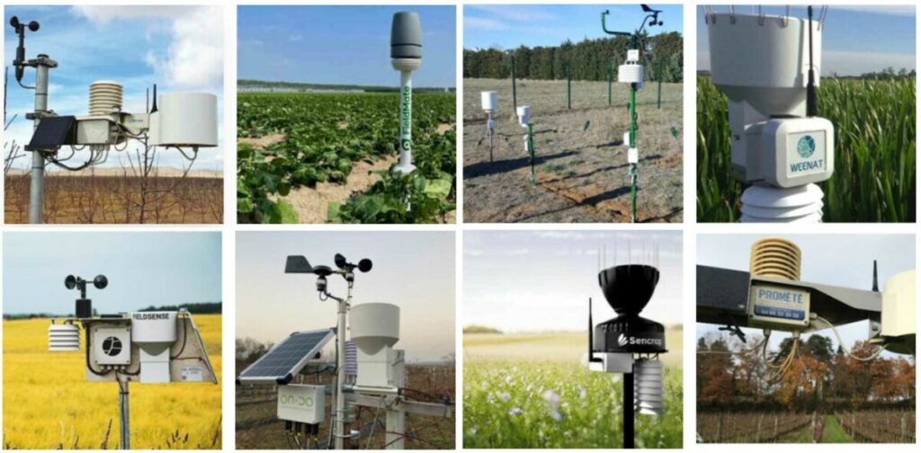
Figure 1: Patchwork of some connected weather stations on the market
Soutenez Agriculture et numérique – Blog Aspexit sur TipeeeDefinitions, data and use cases
A weather station is not so many things. It is a data acquisition system (all the sensors installed on the station), a data storage system (called “datalogger”) when the data cannot be transmitted directly to an external database (hosted by the station provider or someone else), and a system for sending the data from the datalogger to an external database through specific networks. Some weather stations also have solar panels to be more or less autonomous in energy and to make the sensors work.
In terms of available sensors, we can find many different tools to measure climatic parameters (not all are necessarily present on all stations):
- Thermometer: for air and/or ground temperature
- Rain gauge: for the cumulative rainfall. This is probably the factor you can control the most easily (unlike relative humidity).
- Barometer: for air pressure
- Hygrometer: for relative humidity
- Anemometer : for wind speed and direction (gusts and others)
- Pyranometer : for solar radiation
- Dew point sensor or humidity sensor : for foliage humidity
- Capacitive probes and tensiometers: for soil moisture
Data can be acquired at a given time or aggregated over a fixed time interval (e.g. the average temperature over the last 5 minutes). Once the climatic data is acquired, the data can be stored in the memory of the datalogger installed on the station if they cannot be transmitted directly to an external database (when there is little or no network for example). Some manufacturers choose not to transmit the data immediately after it is acquired to save energy, and only send data at regular time intervals.
The final step is to send the data to an external database for storage and access. Several communication protocols are used to send data from the datalogger to the external database. We find in particular data transmission by GSM, GPRS, Lora, or Sigfox. If all these terms seem abstruse to you, don’t worry, it’s actually not very complicated (a mini blog file will soon be available on this subject).
You certainly know Wifi, 4G or Bluetooth! They too are communication protocols. The difference between all of them? The energy consumption to send data, the time needed to send data (we talk about bandwidth), and the distance up to which we can send data (the range).
Why use GSM, GPRS, Lora, or Sigfox protocols rather than the ones you know? Simply because they have a low energy consumption, and a fairly long range which allows to have autonomous sensors in time and to send data to a database far enough from your farm. Wifi is good at home, but as soon as you are a bit far from your box, you don’t get any reception, so it’s complicated to set it up in a field. The 4G, we can get it everywhere (okay, there are white areas), but it’s quite energy consuming so it’s not great if you want sensors that last in time from an energy point of view.
Weather station providers will prefer to transmit their data via Lora (developed by Orange) or Sigfox because they are newer protocols, and have very low power consumption. The range is large enough (with many antennas and repeaters all over France) to make sure that the data is transmitted all the way (there are still sometimes problems in mountainous and remote rural areas). And in the case of weather data, we realize that it is not so serious if we do not have the data exactly in real time, so we can accept that the bandwidth is not too important.
Just to finish on the terms used: GSM is a bit the ancestor of 4G when there was no mobile internet. At that time, thanks to GSM, we could send SMS. We then moved to the 2G protocol, which allowed us to send MMS. You know the rest with 3G, 4G, and maybe 5G. Each time, energy consumption, bandwidth, and range evolve. GPRS is a protocol around 2.5G. You may have already seen Edge noted on your phone. You could say that it corresponds to 2.75G.
Finally, when you access your weather station data – from a website or from your mobile app – you are actually connecting to the external database that your data was sent to. You are therefore finally viewing all your data collected by your weather station. The calculations performed on your weather data (agronomic models, evapotranspiration…) are not performed directly on the weather station but generally on a server that connects to the database that contains the collected climate data.
Weather stations are starting to take off because we realize that there are many possible uses. Let’s go for a little non-exhaustive tour!
- Monitoring the risk of frost with temperature sensors that measure dry and wet temperatures in the plots. The wind can also be used as an indicator in the sense that the wind can stir up the air and raise the temperatures
- Disease risk monitoring (scab, codling moth, powdery mildew, fire blight, devil’s bug…) by following the evolution of rainfall and foliage moistening
- Irrigation control using rain gauges, tensiometers and capacitive probes, and dendrometers. This control is still rarely anticipated and rather considered when there are problems. Although some geographical areas are well supplied with water, the management of this resource can be improved
- Monitoring the quality of the treatments carried out. Wind and/or hygrometry measurements can help to postpone or advance a treatment. The level of rainfall can provide information on the leaching of products. Wetting could also be used to limit spraying times to limit contamination.
- Crop monitoring by tracking the degree of crop growth (sum of degree days), or branch and/or fruit enlargement
- Mapping or zoning of precocity
- Monitoring the risk of sunburn
- Monitoring of global warming, with long time series of data
- Delineation of agro-climatic zones or production zones: these are applications on a larger scale than the farm, for a cooperative, a producers’ association or a technical institute
How to consider the acquisition of weather data?
To use climate data on your farm, you need a weather station. Without talking about station suppliers as such, there are several ways to consider a weather station.
Own weather station OR reference weather station?
Should you install your own weather station at home or use the data from a reference station? Should you install your own weather station with reference standards (for example Météo France standards) or not? It will depend on a lot of factors, especially if the reference station is close to the farm or not, if your soil and climate conditions are very heterogeneous on your farm, if you have the budget to install your own station, or even depending on the climatic parameters you want to monitor (the reference stations close to your farm may not be specific to arboriculture). We will come back to some of these points later in this document.
Real weather station OR virtual weather station?
So, no, we are not in the 4th dimension here. When we talk about a virtual weather station, it means that we use spatialized climate data (from French weather models or others) and that we do as if each position on the territory (where we have climate data) was a weather station. For example, if we use temperature data at a spatial resolution of 1 km (i.e. we have a temperature data on 1 km wide grids), it is as if we had a virtual station every km. When you ask for the temperature at a location on your farm, the temperature is retrieved from the nearest virtual station (or the nearest grid cell).
So is it better to choose between a real or virtual station? The real weather station really measures what is happening in the field, unlike the data from a climate model (which needs to be well calibrated with respect to what is happening in the field). It is therefore necessary to consider the level of uncertainty that may exist between a weather station in the field and what is proposed by spatialized climate data providers. If the calibration is good, the virtual weather station makes it possible to free oneself from all that revolves around the maintenance of the station since this station does not exist in reality. However, there is a subscription or a fee to pay for the retrieval of the data.
In the case of the real weather station, you will of course have to pay for the station and potentially a subscription to use a mobile application or an associated website. Also keep in mind that the virtual weather station will not give access to all the climatic parameters potentially accessible from a real weather station (leaf wetness sensor or other…). The choice of a real or virtual station can also depend on the size of the farm. Larger farms may be better off using virtual data, perhaps combined with one or two field stations to properly calibrate the data.
Network of weather stations OR isolated stations?
Whether you have installed your own station at home or not, the question is then to know if there is interest to join an existing station network or to create one. Is there any interest in sharing climate data with your neighbors? Yes, most certainly if the exchange is done on both sides, i.e. if joining a network allows you to have access to the climate data of the people in that network, while making yours available. This allows you to reduce the cost of data acquisition and to share your data in a community. An additional interest could be to benefit from subscriptions to alert network services, for example for scab, based on climatic data from station networks: “We work on the biology of the fungus to know the maturity rates of the perithecia and the projection levels. As soon as there is rain, the producers receive an email/sms to know if there is or will be contamination. It is a network that is appreciated at the regional level“.
One of the complexities behind the weather station network has to do with the harmonization of the climate data passing through the network. If these climate data are not from the same brand of stations and/or if the sensors are not well calibrated, then how can you trust the climate data around you? It also depends on the accuracy of the data you want to have. Do you want to know if it is very windy or not for your neighbors, or do you want to know to within 5km/h how windy it is a few kilometers away from you?
This harmonization also has an effect on what will be done with the data, especially if they are integrated into a decision support tool (DST) for example: “A network of weather stations is a pain to manage. When it’s connected to the DST and it doesn’t work, the producer will say that the DST doesn’t work when, potentially, it’s the weather data that’s not working. I believe in the interest of the stations, but there is a minimum of considerations to be made by the farmer, but it is not taken into account enough“. Some weather station network owners go even further by separating the stations they own and therefore manage from those owned by farmers: “Since the farmers’ stations are not validated, we don’t use them. There is a network of stations [of company X] of farmers around us in the same sector and the agris consult the data of the others, but we do not validate the data“. This avoids the need for these station network managers to deal with the maintenance and upkeep of the farmers’ stations (see the section on weather station maintenance below).
What are the issues around weather stations?
There is no shortage of suppliers of weather stations for agriculture… So of course, there is a lot of competition, but it is not easy to find your way around. There are many players positioned in France and the list is not exhaustive: Agralis (Aqualis stations), Agriscope, Bosch (Deepfield stations), Isagri (Meteus stations), Lemken (IqBlue Clara stations), Pessl Instruments (IMetos stations), Promete, Sencrop, TCSD (Comsag stations), Weenat…. I’ll let you go and continue digging on the directory of digital tools for farmers.
These suppliers of weather stations are not all manufacturers but for many assemblers. That is, they are not structures that build their own sensors but rather will buy them from sensor manufacturers to assemble them on a weather station. This is not a problem in itself, on the contrary, but it is important to bear in mind that some suppliers may have the same sensors as their competitors. These assemblers will be able to differentiate themselves by the type of specific sensors they can install on their station or sell next to it (leaf wetness sensor, dendrometer, probes and tensiometers…), the number of sensors they can install on their station or the capacity of their acquisition boxes to integrate all types of sensors (including sensors that you could have bought elsewhere). It can also be interesting to know if the sensors sold are dissociable (with their own antenna and transmitter) so as not to necessarily place all the sensors of a station in the same place.
How then to choose a supplier besides these technical considerations? A first obvious answer could be on the quality of the data, but it has to be known (we will talk about data quality in the next section). Some projects are underway to compare the quality of data from weather stations of different providers. The “Meteo Prec” research project aims to validate weather data from suppliers based on Météo France controls (although the standards of acquisition in the field must be the same as those carried out by Météo France). Will these conclusions be valid in the case of arboriculture? Perhaps, it will be necessary to make sure. Other answers come to mind of course: price, ergonomics, interoperability with DMOs or other weather stations… All the topics to help you choose are discussed in the rest of this summary document.
Quality of the data from weather stations
It goes without saying that working with data from weather stations is only interesting if the data is of good quality. Of course, part of this quality depends on the manufacturer (accuracy and reliability of the sensors, uncertainties of the measurements…) which you don’t really have control over – except choosing your manufacturer. But you have the ability to greatly influence the overall quality of the data from the stations installed on your farm. As one of the interviewees told me, “You can always nitpick about the uncertainty of the sensor, but it’s much less than the uncertainty of the variability“. Understand that the issue is much broader than the quality of your station supplier’s sensors. We will come back to all these elements in more detail, first on the accuracy of the sensors themselves, and then on all the logistical issues around the quality of the data with notably the positioning, the number, and the maintenance of the weather stations!
Accuracy and reliability of sensors
Not surprisingly, the more you pay for a weather station or a sensor, the more likely it is that the climate data collected will be accurate. This is of course not a general truth, but it remains the trend. Some weather stations will prefer to integrate several relatively inexpensive sensors to measure a climatic parameter by averaging the results of these sensors rather than installing a very expensive one. Some manufacturers have installed monitoring cells that check for sensor drift (some sensors tend to drift over time, i.e. the data lose reliability over time). Others will be able to compensate for a lower quality of data by a faster acquisition frequency (e.g.: one data every 30 sec, every 2 min…) at the cost of a slightly lower battery autonomy, leaving you more time to intervene. Note that with some suppliers, the frequency of data acquisition is modifiable.
The sensors are therefore not all necessarily very accurate: “In the rain, either you have cheap sensors [company X], or very expensive ones [company Y], or intermediate ones. But the fact is that they often fail. Often, we put this on the spatial variability of rainfall until we highlighted that there were problems on the pluvio[meters] “. Still on this rainfall example, keep in mind that rainfall is a more difficult parameter to correct than temperature or humidity. It is easier to extrapolate a temperature or a humidity around us than a rainfall, given the spatial variability of rainfall, even within a small area (could we imagine single correction sensors rather than whole stations with many sensors installed?) Nevertheless, we would like to make sure that the sensors do not tell everything and anything either, hence the importance of sensor calibration by the station providers and of validation of the collected data: “If you don’t ask questions about the station data, it can lead to problems“. The validation of data from station suppliers can be done, for example, from reference stations and protocols set up by technical institutes or experimentation centers.
Are all these issues of accuracy and reliability necessarily a problem? A more relevant question would be whether or not, for the purpose of the data, the accuracy is sufficient. Do I need to have a temperature to the nearest degree? How sensitive is the model I am using to a variation in temperature or rainfall accumulation?” For humidity, we are testing bad game sensors because we figure that when we need accuracy, it’s the 3 months of spring (for disease development).”
Weather station positioning
Properly positioning your weather station(s) on your farm is essential to ensure good representativeness and completeness of the data collected: “We will not position in the same way a weather station whose objective is to monitor frost, or one whose objective is to monitor disease risks. Natural obstacles are also elements to be taken into account. We know that for accurate rainfall measurement, you need a clear environment to avoid the screen effect of certain trees or buildings”; “In an existing orchard, it is the size of the tree that gives the idea, the tree must be representative and the station must be positioned where there is no strong external influence (decaying orchard, orchard attacked by voles, etc.)“. It is important to be aware that the representativeness of the measurements will not necessarily be the same at the top or bottom of a plot, near or far from a hedge, or near the edge of a plot. Some experts also advise to take a strong interest in soil profiles to have a well known and representative installation area. These soil variabilities can be highlighted with the help of digital tools (soil conductivity/resistivity, satellite imagery), but also and above all from your knowledge of the land. You know if there are stones, or if a soil is settling, and can place your stations accordingly. No one has this expertise better than you. In the same way, you know where the frost spots are in your plots and you know the places that are most susceptible to disease or pest attacks. You therefore have the ability to orient the positioning of the stations so that the risk of frost or disease is as representative as possible.
The positioning of the stations can also be governed by standards, and these are not necessarily the same for everyone. For example, some may choose to install stations within the framework of French weather standards (with sensors at a certain height, in a clear area…) but it must be clear that the data are good where they have been measured (the data are not all measured at the same height from the ground for example). Between a station positioned in an open area and one installed in the heart of the orchard, the conditions will not be the same. In the heart of an orchard, the climate of the crop will be much better reflected and the climatic data will better reflect the situation. The major drawback is that most agro-climatic models and/or disease models are or have been calibrated to the French weather standards. Are the differences significant? Do we have to revise the Decision Support Tools if the stations installed are not up to French weather standards? Not necessarily all the time, but it is still necessary to keep these ideas in mind (be careful when starting to make more detailed analyses, for example with dendrometers or others).
Number of weather stations
How to choose the number of stations to set up? This is a tricky question because it depends not only on the variability of the climatic conditions and the number of heterogeneous zones (you must already be able to define them) on the farm but also on the budget you have available. So you have to find a compromise between completeness and cash! Perhaps it is necessary to start by multiplying the measurements, and to degrade them progressively to see the moment when you start to lose in precision.
Maintenance of weather stations
Whether you like it or not, it’s hard to escape weather station maintenance. A station is not something you just set up and leave alone for the season. Maintenance is particularly useful to do preventive work and avoid or at least limit the curative work, i.e. the management of problems as soon as they occur. Logistical problems around the stations can take many different forms: battery problems, breakdowns and breakages of all kinds, sensor drift, wear and tear of parts, clogging of the rain gauge, storage of the weather station, etc. Some examples perhaps a little more telling: “it snowed in the Alps on December 11, the snow took 3 days to melt in the rain gauge, and I had to postpone all the rains of December 12, 13 and 14 on the 11th”; “weather stations are sometimes returned in the off season (wintering). This can be a concern for the operation of the Decision Support Tools, which need continuous data series and sometimes data over these periods.”
What strategy should be adopted for the maintenance of these stations? Once again, there are many answers. Putting the price on more autonomous, robust and durable sensors on the stations will limit the maintenance task. On the contrary, inexpensive sensors will have to be changed regularly (and most likely recalibrated). But the question could also be: Who takes care of the maintenance of these stations? This may depend on whether you own the station or rent it. Are you able to do it yourself or is it a separate service? Is your station provider responsive to the maintenance and upkeep of the installed weather stations? The views of the actors interviewed on this question are quite categorical – all are more or less in the same direction: “maintenance is important. We go there once a year and visit it. Since we own the station, we do the maintenance. We ask the farmer to notify us if there is a problem. Most of the budget for our system is for maintenance. It should not be managed by the producers. There is standardization of practices. It has to be a technician, always the same one, who comes regularly”; “It’s certainly not something that can be delegated, but pooling with other networks or manufacturers, that’s okay”. “The time of the maintenance is also important. We have to do the maintenance between the end of February and the end of March”; “Who does it? Is it a service or something else? Some weather stations, the producer installs it but does not do the interviews. Producers are into the idea of having stations at their homes, but the question for me is wide open.” “You don’t need a company that just sells a product. It has to be accompanied behind it. We manage the technical side, but it can be a bit heavy too, we often have other things to do. It’s mainly because the arborists don’t have the time that they don’t do it, not because they can’t do it. To get the station back up and running, the agris will call back. We also help because for us, it is important to have a good network. The data sharing aspect is interesting.
And you, what is your opinion on the question? In any case, it could be interesting that the station maintenance booklet be linked to the collected climatic data to be able to question their quality if the maintenance is not well done.
Weather Stations and Interoperability
Having your own climate data is already good. We can actually do a lot of things with the raw data collected. When you want to go a little further, you can rely on the expertise of technical institutes, industrialists, research centers, or even associations that have been able to set up models for disease development or irrigation control, whether as a result of experimentation, research or empiricism. These models or algorithms are often made available in the form of DSTs (decision support tools). And you may already use the Rimpro models, the Mills curves, the models developed by INRAE or DGAL (Inoki and others), or those of Arvalis.
As soon as you have local data, on your farm, the interest is to run these models with your data. Ask yourself if your weather station provider already links to these models, which could save you precious time. We talk about interoperability if two actors already communicate with each other, for example a weather station [from company X], and the scab model of the platform [from company Y]. In this case, there is no need to retrieve data from the weather station and integrate it into the platform. This is all handled automatically by your weather station provider (if interoperability is present). Another way to manage interoperability is that, from the DST, you can fill in the weather station present at your location. In both cases, from the platform or from the DST, you make the link between the climate data and the model you want to use. If interoperability is interesting in the sense that it allows you to integrate other data (not only weather data for example), you should also ask about the ease of exporting your data in case you need it, so as not to remain bound hand and foot to a supplier.
This interoperability nevertheless raises a number of points of attention. I come back to the problem of harmonization of climate data that we saw earlier when we discussed weather station networks. Since the weather stations, depending on a whole bunch of quality parameters that we mentioned, can provide data of different quality, will these climatic data have an influence on the output of the model used? In other words, if I use the station of a supplier A or that of a supplier B, will the results of the model be different? Are there any threshold effects that might occur? Also, make sure when using a model that it is well suited to arboriculture. An irrigation model for grapevines, for example, cannot necessarily be transposed as is to arboriculture, for obvious reasons of the differences in cultural itineraries.
As for the use of DST themselves, it is not obvious either. The first is the “black box” problem of the models used, or the fact that you use a model without really knowing what is behind it. You need to be able to know what kind of climate data is used in the model, and how the model works! Some institutes or consultants will prefer to give you the interpreted results directly from the DST to make it easier to read: “We have a relationship with the DST vendors; I work a lot with [company X] for example. I work a lot with [company X] for example. We provide all our data so that they can rework the calibration of the data, but it is more a question of interpretation and we know what we can do with our data. I don’t feel comfortable giving the producer the model outputs directly, without any hindsight on the DSTs”; “All the models we use are combined with biological measurements as well. [Company X] anticipates the risk of scab too early for us. We use it to estimate the risk in real time. As for when it starts and when it ends, the models must be put into perspective in relation to biological observations. For me, modeling without complements (on the phyto side) is dangerous because I risk underestimating and not covering real risks”; “For the models we use, there are coefficients that are not the same between the different places. It is important to have some control over the model because conditions are not the same everywhere.”
The support of a technician can therefore be particularly relevant here to digest the data, and to reduce your mental load. However, be careful not to depend completely on your technician to use the weather data: “The producers need the technician and the technician needs the weather data that the producers can provide. It is not necessarily the producer who will benefit from the data that is generated at home. It is perhaps the technician who will translate the data to advise his producers.”
An additional point of attention: Several public models, notably those of the INRAE or the DGAL, were hosted and maintained free of charge by the CTIFL. This will soon no longer be the case. The CTIFL works more and more with private funds and is more oriented in a commercial approach. You will only have access to private models and/or private services.
Ergonomics and Interpretability of data
In order to get the most out of the climate data you collect, you must be able to visualize, understand and interpret them easily. The key word: SIMPLICITY. Choose providers that give you access to a mobile application (or website) with an ergonomic and highly visual interface. You must be able to consult graphs, visualize historical data, superimpose curves, set thresholds, basically everything that will allow you to better understand the weather conditions on your farm. You must be able to easily navigate through the tool, use the visualization mode that best suits your needs, choose the temporal frequency of observations that corresponds to you (every hour, day, month…), everything that will make the tool the most user-friendly for you.
How to display the weather information or the results from a DST? You will tell me that the answer is trivial and that it is enough, as I said before, to show curves and weather history, and to discuss with your advisor and/or technician (I refer you to the section on interoperability). So, of course, this is interesting. But going a little further, how to display a disease risk or a weather uncertainty? How to integrate this information visually in an interface so that it is taken into account? Taking risk into account means that we can no longer work systematically, but in a predictive manner: “Scab protection is the biggest treatment. From mid-May, we do a biological follow-up. If we have almost no spores projected and [company X] gives us a storm at 50%, we push not to intervene. But not all growers do it.“
The notion of risk and uncertainty is not easy to grasp because it depends on many different considerations: production objectives, constraints, personality, risk aversion… Risk-taking is different between a small and a large farm because not all plots can be covered quickly. And as one of the interviewees added: “The more you use tools that are subject to interpretation, the more questions you ask yourself. For the risks of scab, when you receive information with risk/non-risk, you don’t have the contradictory means to ask yourself the question, so you rely on the collective network – which doesn’t necessarily correspond to your own“. Even if this notion of risk is complex, it should not be neglected, and it is therefore necessary to be interested in what the interfaces outline.
Economic considerations
Ah, cash, we always end up coming back to it (or we always start there). Of course, the budget is to be considered and will guide the strategy of purchasing one or more weather stations, specific sensors, subscriptions to DSTs / Platforms / Station networks / Spatialized data from virtual stations… In short, everything depends on your strategy, your constraints, and what you want to do with the climate data.
A first advice: be interested in the business models of those who provide weather stations. Do they offer to rent the weather stations? Is it possible to test the equipment before buying it? Are there any commercial packages? Is the after-sales service responsive and costly? The same goes for subscriptions to station networks. In some networks, you become a member and can pay for the surface of your farm. You will also have the possibility to have your own stations in addition to the network, but you will have to pay for the station if you do so (unless the business model is different).
A second piece of advice: it may seem silly to say, but think about the purchase of your stations. It is not necessarily useful to invest in many state-of-the-art stations, all equipped with the best possible sensors. If a well-equipped main station is certainly interesting, the others can be equipped with sensors specific to your objectives (and whose precision is also linked to your objectives), a bit like the example of the single-sensors scattered everywhere that we mentioned earlier in the document. Finally, don’t forget that there is help to get equipped in France
In conclusion
The weather station is not that complicated, but it raises a number of logistical, economic and strategic issues that need to be considered with care. The weather station remains a good technical tool to make savings in inputs. Its essential role is to support the organization and management of production (irrigation, pests, etc.). Use cases and arboricultural applications will undoubtedly gain in quality with the improvement of climate data forecasting. Let’s keep in mind, however, that agriculture was done before we had weather stations. It is not a mandatory lever either but it remains an interesting tool.
Soutenez Agriculture et numérique – Blog Aspexit sur Tipeee